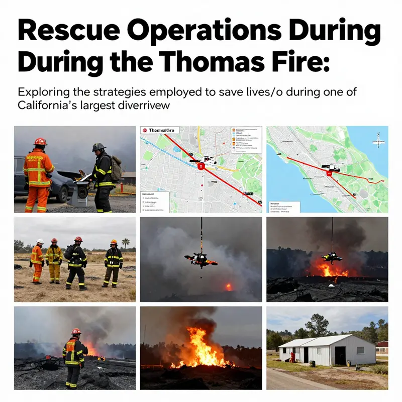
The Thomas Fire that swept through Southern California in December 2017 marked a significant moment in wildfire history, necessitating a robust and multifaceted rescue operation. As flames ravaged more than 440,000 acres, emergency responders faced formidable challenges in protecting lives and property. Understanding the systematic approach taken to rescue individuals during this crisis reveals the critical roles played by emergency response teams, the implementation of evacuation orders, and aerial support operations. Furthermore, the establishment of shelters and support mechanisms were essential in providing relief to the displaced population. Each chapter of this article will delve into these key components, illuminating how coordinated efforts culminated in successful rescues amid devastating circumstances.
Coordinated Lifelines: How Emergency Response Teams Orchestrated Rescues During the Thomas Fire
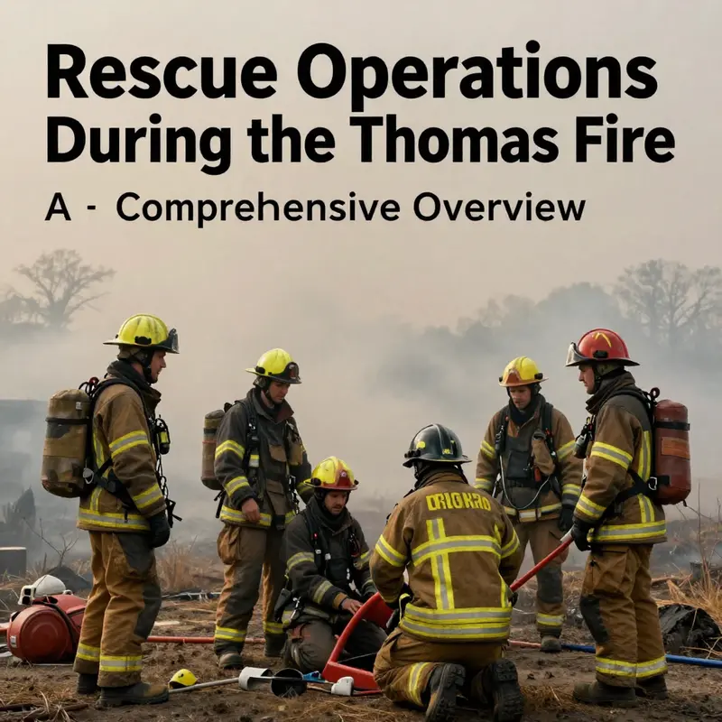
The Thomas Fire that roared through Southern California in December 2017 was more than a blaze; it was a moving test of coordination, courage, and community endurance. Its enormous scale—burning across vast swaths of Ventura and Santa Barbara counties and swallowing neighborhoods in a matter of hours—demanded a rescue response that could outpace both the flames and the shifting winds. In the most perilous moments, when streets turned to smoke-filled corridors and roads became channels of blackened heat, rescue operations depended on a seamless orchestra of emergency response teams. They did not simply react; they planned, adapted, and synchronized efforts across agencies, jurisdictions, and even state lines. The story of how thousands of people survived the Thomas Fire is as much about strategy and timing as it is about bravery on the ground.
Central to this story was evacuation planning conducted by local fire agencies and incident managers who understood that the early, proactive movement of people from danger zones could prevent many tragedies. Door-to-door evacuations in hard-to-reach areas such as Montecito and parts of Santa Barbara were not random sweeps but carefully mapped operations guided by fire behavior, wind forecasts, and real-time terrain assessments. Evacuation plans were not static; they evolved as fire lines shifted and new threats emerged. In this sense, the operation resembled a living blueprint in which information flowed in from the field to a centralized command and back out to residents at risk. The human element remained constant: teams who carried radios instead of romance, maps instead of signs, and a shared commitment to safeguarding life above all else.
At the backbone of this effort stood Cal Fire’s Incident Management Team (IMT), a cadre of seasoned managers who provided strategic oversight amid the chaos. The IMT’s role was not to fight the fire single-handedly but to synchronize field operations, align resource procurement with need, and ensure that crews, vehicles, and aerial assets were deployed where they could save the most lives. This required rapid assessment, clear prioritization, and an ability to foresee where a breakdown in evacuation could trap vulnerable residents. The IMT functioned as a nerve center, translating the raw, often contradictory signals from the terrain into a coherent plan that local agencies could execute with confidence. The success of evacuations across the affected corridor depended on that clarity, especially in communities where smoke and heat could overwhelm even the most determined residents.
The National Guard added a different dimension to the rescue effort, bringing additional mobility, logistical support, and a capacity to reach isolated neighborhoods where roads had become impassable or dangerous. Guard personnel staffed evacuation points, moved people to safety using specialized vehicles, and supported ground operations with disciplined, large-scale organization. Their presence allowed civilian responders to focus more intently on assessment, triage, and direct rescue operations without the constant concern that a critical transportation bottleneck would strand families amid the flames. In the most extreme cases, the Guard’s ground and logistical capabilities bridged gaps when access was compromised, enabling roving rescue teams to reach households that would otherwise have been cut off.
Law enforcement agencies played a crucial, often underappreciated role in maintaining order and safety during a period of mass movement. They facilitated traffic control to prevent gridlock at key intersections, secured evacuation routes, and helped enforce mandatory orders that could not be ignored without risking lives. Their presence helped create predictable corridors through which ambulances, firefighting units, and search-and-rescue teams could move efficiently. This brought a layer of protection to residents who might otherwise have felt overwhelmed by the sheer volume of people leaving with little time to prepare. The coordination between law enforcement and fire agencies also meant that information could be shared quickly with residents who were leaving and with those who remained and needed timely, actionable warnings.
Search-and-rescue units stood at the tip of the rescue spear. Equipped with helicopters, all-terrain vehicles, and a readiness to move through smoke, these teams were tasked with locating individuals cut off by the advancing walls of flame. Time mattered, and every minute saved translated into a life saved. In scenarios where streets were blocked by debris or heavily burned sections of road, aerial assets could drop crews into safe zones or extract people from rooftops and yards where escape routes had disappeared. The ground teams, meanwhile, moved through neighborhoods with careful persistence, knocking on doors, listening for signs of occupants, and conducting welfare checks. The synergy between air and ground rescue operations was essential; while helicopters could remove those in imminent danger, ground teams could secure the exit paths and provide immediate medical attention as people arrived at safer ground.
The Thomas Fire underscored the importance of robust communication and alert systems. Real-time information flow, from field weather observations to command decisions and, crucially, to the public, emerged as a defining factor in how well people responded to evacuations. Authorities leveraged Wireless Emergency Alerts (WEA) and social media to issue urgent orders, safe-practice guidelines, and route updates. The immediacy of these channels meant that residents could receive life-saving instructions even if they were cut off from traditional landlines or faced with flooded neighborhoods where the only reliable lifeline was a cellular network. The WEA system proved particularly valuable for reaching individuals who might otherwise have missed notices delivered through door-knocking or radio broadcasts. The rapid dissemination of alerts helped to reduce delays in evacuation and, in many cases, allowed families to reach safety before flames closed in.
This emphasis on rapid communication did not depend solely on government devices; it depended on the resilience of communities and the willingness of residents to heed warnings. Social networks, neighbors, and local organizations amplified official notices, creating a broader safety net that extended beyond formal channels. The lesson here extends beyond any single incident: when people understand the warning signs, know where to go, and have a plan to move quickly, the likelihood of a successful rescue increases dramatically. In the Thomas Fire, this dynamic was reinforced by ongoing professional training and by the presence of seasoned responders who had practiced similar evacuations in the past. The work of these teams—planning, coordinating, and executing under duress—was not merely about putting people in buses or helicopters. It was about preserving human dignity in the face of fear, ensuring that the most vulnerable among us were accounted for and escorted to safety with the same urgency as anyone else.
As the fire progressed, shelters and emergency centers became critical junctures in the rescue narrative. Evacuees needed more than a ride out of danger; they needed food, water, medical attention, and a secure place to rest and regain strength. Shelters offered not only immediate relief but also a sense of continuity and care during a frightening upheaval. Volunteers and emergency personnel established a network of staging areas where displaced residents could check in, receive basic necessities, and connect with loved ones. In addition to the tangible support of meals and blankets, shelters provided medical screenings, counseling, and child-friendly spaces, which helped mitigate the psychological strain of evacuation and displacement. For people who lost homes or vehicles, shelters represented a bridge to the next steps—temporary housing, case management, and a path toward recovery whenever possible. The coordination of shelters depended on transparent information flows so that those in need could locate the nearest center and confirm what essentials were available on the ground.
Behind the visible actions—the helicopters circling above, the convoy lines of emergency vehicles snaking along burned streets, the door-to-door calls from responders—lay a culture of collaboration that transcended agency boundaries. Mutual aid from neighboring jurisdictions, state resources, and even out-of-state support flowed into the affected counties in a well-rehearsed cadence. Agencies shared plans, maps, and casualty information to optimize each hour of response. This interagency choreography required trust, shared standards, and a willingness to adapt under rapidly changing conditions. It also highlighted the value of ongoing training and preparedness: the more responders drill together, the more fluid their collaboration becomes when the real emergency arrives. Professionals who might have trained in classroom settings or simulated scenarios found themselves applying those lessons in a live environment where stakes were existential and lives hung in the balance.
The Thomas Fire reinforced a broader truth about rescue operations in severe wildfires: rescue is rarely a single act. It is a sequence of decisions, each contingent on the next, built from prior experiences and real-time evaluation. Evacuation timing was crucial; once flames reached certain thresholds, the window for safe movement began to close. The IMT’s ability to anticipate when to shift from proactive evacuation to emergency containment, to re-route traffic, and to deploy additional resources, was central to saving lives. The National Guard’s precision in moving people from neighborhoods cut off by smoke and flames, the law enforcement-led management of corridors, and the tireless search-and-rescue efforts formed a continuum of care that extended from the first siren to the moment evacuees reached shelter and, in time, a safer horizon. The rescue narrative of the Thomas Fire is not a catalog of heroic acts; it is a testament to the power of coordinated action when expertise, equipment, and empathy converge.
Within this broader chronicle, professional training and preparedness stood out as enduring enablers. They ensured that responders did not improvise in a vacuum but rather aligned their actions with proven procedures and shared priorities. Training translates into faster triage, smarter routing, and better decision-making during overwhelming intensity. It also shapes the culture of resilience that allows responders to maintain calm under pressure, to listen to community needs, and to recognize when additional support from outside agencies is required. The ongoing commitment to safety education—whether through formal certification programs or targeted drills—helps communities and responders alike to confront future fires with a steadier hand and a clearer vision of what rescue success looks like when lives are at stake. To emphasize a related thread in professional development, consider Fire Safety Essentials Certification Training, which equips individuals with foundational knowledge and practical skills that complement the large-scale operations witnessed during events like the Thomas Fire.
In sum, the rescue narrative of the Thomas Fire is a story of organized complexity. It shows how multiple layers of response—from local firefighters who knew their streets to national-level teams with the capacity to move people out of harm’s way—coalesced around a single objective: to preserve life under extreme pressure. The improvisational elements of the response—rapidly updated maps, shifting evacuation orders, and the improvisation of shelter locations—were anchored by a shared mission and a chain of communication that worked under duress. The result was not merely the evacuation of thousands of residents; it was a showcase of how contemporary emergency response works when it functions as a collaborative ecosystem. As communities recover and reflect on the lessons learned, the Thomas Fire stands as a powerful reminder that rescue is a collective act—one that depends on planning, leadership, courage, and the everyday readiness of people and institutions to answer the call when danger arrives.
External resource: https://www.oes.ca.gov/Reports/ThomasFire_AAR.pdf
Internal link for further reading: Fire Safety Essentials Certification Training
Signal to Leave: Evacuation Orders that Guided Rescue During the Thomas Fire
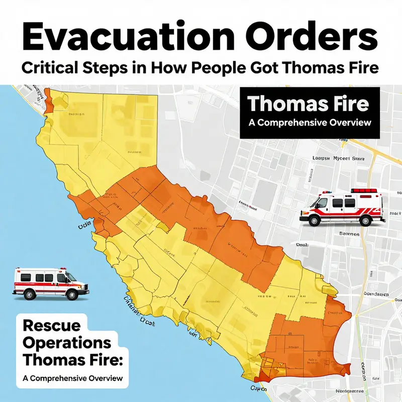
The Thomas Fire rose from a single ember into a rolling wall of heat and flame that swept through coastal California in December 2017. Its scale, spanning hundreds of thousands of acres across Ventura and Santa Barbara Counties, tested firefighting capacity and the speed at which people could reach safety. Evacuation orders formed the backbone of the rescue effort, translating meteorology, fire behavior, and on the ground judgment into a sequence of critical decisions. When speed mattered most, the phrasing and timing of those orders could mean the difference between a safe exit and a perilous stand in place.
The decision to issue an evacuation order rests on a convergence of data streams across agencies and levels of authority. Local officials, CAL FIRE, county sheriffs, and state agencies worked together to interpret fire perimeters, wind forecasts, heat intensity, and road conditions. The evolving threat required issuing orders early for the most threatened areas and revising them as conditions changed. Parts of Ventura County were told to depart while neighborhoods near Montecito faced renewed urgency as wind shifted or embers jumped gaps that had appeared closed before. The evacuation map was a living document updated with new intelligence and consumed by residents through multiple channels.
Public alerts mattered as much as the orders themselves. Authority across a broad toolset—mass notification systems that pinged phones with location specific instructions, social media updates, and trusted local outlets—sought to explain not just when to leave but why, and how to leave safely. Officials highlighted viable routes, transportation options for those without cars, and when it was safest to depart with family, pets, and essential belongings. The best orders gave practical guidance about where to go, what to bring, and how to access shelters once you reached safety.
The rescue dimension depended on protecting life and property. As roadways became chokepoints and neighborhoods were cut off, orders allowed responders to stage resources, set up checkpoints, and guide traffic toward safer corridors. This coordination helped prevent gridlock and opened routes for returning evacuees when conditions allowed. The impact was tangible: hundreds of homes survived because a proactive, well-communicated evacuation system functioned in concert with on the ground rescue efforts.
Air operations added a critical dimension. Helicopters bridged gaps created by blocked roads, lifting people from yards or improvised landing zones to safety or medical care. Aerial surveillance gave ground teams situational awareness, tracked ember distribution, and identified pockets of people still in danger. The synergy of air and ground operations demonstrated how layered capabilities can ensure no one is left behind when threats evolve rapidly.
Shelter infrastructure formed a parallel track of resilience. Evacuation orders cleared streets and buildings, but the immediate need for shelter, food, water, and medical care remained. Across the affected counties, schools and community centers became emergency shelters, guided by accessibility for vulnerable populations and mobile units that brought meals, medications, and rides to longer term housing. Shelters also served as hubs of information about routes, road conditions, and power status.
The human element in evacuation and rescue—decisions in the moment and collective community response—proved as consequential as any official directive. Some chose to shelter in place due to family needs or travel constraints, while neighbors formed informal lifelines, sharing vehicles and coordinating rides for seniors or children. These acts of neighborly responsibility amplified the effectiveness of formal orders and strengthened community resilience.
From preparedness to practice, the Thomas Fire underscored the importance of clear, actionable communication. Early warnings, layered alerts, and a network of partners ready to assist vulnerable individuals shaped outcomes. The result was not just moving people out of danger, but enabling safety and well being at every stage of a crisis. The experience informed future practice: a disciplined balance of aggressive, timely orders and robust support for those who needed help to act on them.
For readers seeking to connect historical findings to ongoing preparation, the story offers practical lessons in safety training and readiness. Preparedness reduces the cost of response when danger arrives and well timed, accurate communication empowers decisive action when seconds count. The official Thomas Fire Incident Report provides a comprehensive perspective on the chain of decisions that shaped the rescue outcomes.
Sky Lifelines: How Aerial Rescue Shaped Exits During the Thomas Fire
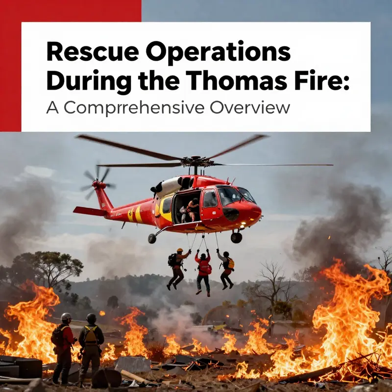
When the Thomas Fire ignited in December 2017, its ferocity and scale were hard to fathom from the ground. It burned with a heat that turned canyons into furnaces and hills into moving mazes of embers. Across Ventura and Santa Barbara counties, the threat extended far beyond the flames themselves: smoke abated visibility, roads buckled under debris, and winds carried scorching gusts that could outrun any hopeful escape route. Under those conditions, aerial rescue operations emerged as a central lifeline. They did not merely supplement ground efforts; they redefined the pace and reach of evacuations. Helicopters and fixed-wing aircraft moved with a different kind of urgency, skimming over rugged terrain, reaching neighborhoods cut off by fire, and lifting people to places where calm, cooler air awaited. The air became a moving conduit of safety, stitching together disparate strands of response into a coherent rescue thread that kept thousands from becoming trapped in advancing flames.
From the outset, aerial assets served several interlocking purposes. They expanded the geographic footprint of rescue, allowing responders to identify pockets of danger and viable egress routes from elevated vantage points. They provided rapid search capabilities, scanning smoke-filled corridors where ground teams could not safely venture. And, crucially, they served as mobile medical modules, delivering care or transporting the most seriously injured to safer ground or medical facilities. The speed of aerial deployment translated into meaningful seconds and minutes saved. When a fire front surged, a helicopter could deviate from its flight path to hover over a vulnerable grid, drop a rescuer, or hoist a stranded resident, thereby opening a window of opportunity for survival that would have closed quickly if left to ground transport alone. The scale of the mission demanded a level of coordination that only integrated air-ground command structures could deliver.
A central feature of these aerial operations was the strategic use of technology to pierce the smoke-blanketed landscape. Helicopters in the Thomas Fire response carried infrared imaging systems that could detect residual heat signatures through thick smoke. Where visibility was non-existent for human eyes, IR imaging provided a map of heat sources—often consistent with people, pets, or heat-retaining infrastructure in structures. This capability turned vague silhouettes into targetable signals for rescue crews below. Night operations, which presented their own hazards, benefited from this technology as well. The flicker of heat signatures against a dark horizon allowed pilots to identify safe landing zones and feasible hoisting points long after daylight had faded. In practice, this meant that a helipad could be established not in a pristine field but on an open slab, a rooftop, or a hillside clearing that had been cleared by land-based teams to receive a patient. The synergy between night vision and infrared imaging allowed responders to extend the airlift window, keeping a steady cadence of sorties even as conditions deteriorated.
The narrative of a typical aerial rescue during the Thomas Fire often centers on the hills around Fillmore, where roads were frequently blocked by debris, embers, and the unpredictable churn of the fire’s spokes. In these areas, ground access was limited, and residents could be trapped on slopes where flames licked at the edges of yards. Helicopters conducted multiple sorties, each mission designed to evacuate a cluster of residents and move them toward safety zones where evacuation corridors had been cleared or where shelters had been established. The experience of pilots, flight coordinators, and hoist operators was steeped in a balancing act: descend carefully into challenging airspace, maintain a steady hover with gusts buffeting the aircraft, and execute a precise hoist or sling-load pickup while the rotor wash scatters ash and debris. The human element here was inseparable from the mechanical. Each operation required an intimate knowledge of wind shifts, fire behavior, and the location of vulnerable residents—elderly individuals, people with mobility challenges, and families without reliable transportation—who depended on these aerial lifelines to reach safety.
Coordination among agencies was the backbone of effective air rescue. CAL FIRE, with its vast ecosystem of firefighting personnel and incident command, worked in concert with local law enforcement, emergency management officials, and medical teams. The aim was to weave air operations into a larger rescue fabric without creating interference among different response strands. This required real-time communications, consistent handoffs, and clearly defined roles. Ground teams relied on air support to identify safe landing zones and to provide overhead coverage that could deter secondary hazards. In return, air crews depended on ground teams to locate the most vulnerable residents, stage medical supplies, and guide evacuees into controlled egress routes. The resulting interdependence created a robust, adaptive system in which air assets were not isolated tools but essential components of an evolving, on-the-ground reality.
The value of aerial rescue extended beyond the immediate relief of people escaping flames. As responders worked to move residents away from danger, they also supported the broader humanitarian mission: ensuring that those who fled had access to food, water, and temporary shelter. Evacuation was not just a one-way movement from danger to safety; it was the beginning of a longer process of stabilization. Shelters and emergency centers became the nodes that received evacuees, offering necessities such as meals, medical attention, and a place to rest after a night of fear and adrenaline. This network of care, connected by the movements of aircraft and the steady cadence of ground crews, reinforced the sense of control in a situation where fear had momentarily overwhelmed many families. It also highlighted an important reality: aerial rescue is inseparable from the human and social dimensions of disaster response.
Operationally, the Thomas Fire response revealed several enduring patterns. First, the air-ground interface allowed responders to maximize resources by prioritizing vulnerable populations. The rescue of the elderly, the disabled, and those without transport was a continuous thread that guided mission planning. Second, the use of fixed-wing transports, in addition to rotorcraft, offered endurance and range, enabling rapid transfer of evacuees to safer zones with less immediate weather risk and better ground access. Third, the ongoing exchange of information—maps, weather updates, and hazard assessments—was essential. Pilots relied on the newest reports from ground observers to determine whether a hillside road could serve as a safe landing site, whether a particular ravine path would be too unstable, or whether a neighborhood could be entered without exposing rescuers to a flashover. The chain of intelligence—from field observations to air operations to shelter management—had to function almost seamlessly to sustain the flow of rescued residents.
Beyond the immediacy of rescue, this aerial work left lasting lessons about training, readiness, and the psychological dimensions of response. The rapid escalation of fire-driven risk demanded that responders remain calm under pressure and adaptable to shifting conditions. That adaptability was, in part, cultivated through ongoing training that emphasized programmatic readiness, cross-agency drills, and the ability to improvise when circumstances demanded. In this regard, responders drew on a shared culture of safety, practiced in simulations and field exercises, to execute high-stakes maneuvers with precision. The importance of training and readiness—evident in the way crews coordinated hoists, identified landing zones, and interpreted thermal imagery—finds practical expression in programs designed to bolster field capabilities. For responders and communities alike, the knowledge that one can rely on trained professionals during a crisis becomes a central part of resilience. See the broader conversation about training and preparedness in fire safety resources such as the fire safety essentials certification training, which underscores the kinds of skills that enable swift, competent action in emergencies. fire safety essentials certification training.
As the Thomas Fire evolved, the shelter network expanded in parallel with the evacuation footprint. Aerial rescue did not end with a successful hoist; it bridged the moment of danger to the longer arc of relief. Evacuees, once delivered to safety, encountered reception centers where food, water, medical aid, and temporary housing awaited. These centers served as transition points—from fear and uncertainty to a provisional sense of security that allowed families to regroup, collect essential belongings, and determine their next steps. The interplay between air operations and shelter services highlighted how a disaster response functions most effectively when it moves in a complementary rhythm: air assets open corridors of escape, while ground services absorb and stabilize the evacuees once they reach safety. The lesson is not simply about the mechanics of airlift or the speed of evacuation. It is about creating an integrated system capable of protecting lives while preserving a sense of dignity for those who bear the burden of loss.
From a historical vantage point, the Thomas Fire’s aerial response stands as a benchmark for how modern rescue operations can adapt to extreme conditions. The fires stitched through terrain that included canyons, ridges, and suburban perimeters, challenging traditional rescue paradigms. Yet the repetition of successful air rescues, the disciplined coordination among agencies, and the utilization of infrared technology all pointed toward a future in which aerial assets are embedded more deeply in disaster response strategies. The story is not merely about the courage of pilots hovering over roaring flames; it is about the collaborative discipline that makes those risky maneuvers possible—discipline rooted in training, communication, and mutual trust across agencies. It is a testament to the idea that when the ground is impassable and every second counts, the sky can become the most dependable route to safety.
For readers seeking a formal account of these operations, the official incident report provides a detailed chronology of air and ground actions, incident objectives, and outcomes. This external resource offers an authoritative view of how aerial rescue performed within the larger framework of the Thomas Fire response. The report captures the complexity of decisions made under pressure and the ways in which technology, teamwork, and timing converged to save lives. In the decades since that event, the stories of sky lifelines from the Thomas Fire continue to inform training programs and resilience planning across wildfire-prone regions, reminding us that rescue is as much about coordination and endurance as it is about bravery and speed. For those seeking a comprehensive official narrative, see the CAL FIRE incident documentation available at https://www.fire.ca.gov/incidents/2017/2469-thomas-fire/.
Shelters as Gateways: Stabilizing Lives After the Thomas Fire
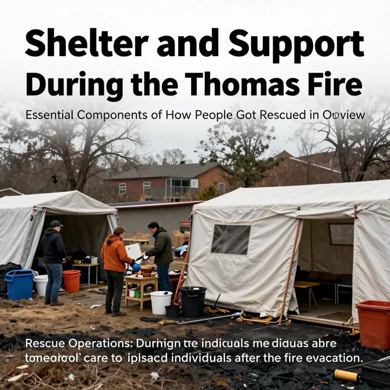
During the Thomas Fire that swept across Southern California in December 2017, integrating shelter operations with case management and health services proved crucial. Shelters transformed from mere stopovers into adaptive hubs where evacuees found not only beds but a pathway to stability. Governments, NGOs, and volunteers collaborated to create evacuation centers capable of serving thousands, with clean water, food, medical care, and mental health support. Crisis counselors and social workers partnered with logistics teams to triage needs, manage registrations, and connect families to longer term housing options, benefits, and legal aid. The shelter network was also a testing ground for equity, as planners prioritized the most vulnerable populations, including the elderly, people with disabilities, and households lacking transportation. The narrative emphasizes how the integration of shelter operations with the broader recovery framework improved safety, reduced confusion, and helped people begin rebuilding routines. Aerial and ground response intersected with sheltering: helicopters delivered evacuees from remote areas to centers; on arrival, medical screenings and triage determined placement into appropriate shelters, with mobility considerations for the elderly or injured. Within shelters, volunteers and professionals coordinated not only meals and sanitation but social and emotional support, offering crisis counseling, information about benefits, and connections to case managers. The support system extended beyond the initial sheltering phase: mobile medical units, on-site clinicians, and partnerships with housing agencies facilitated ongoing care and transitional housing arrangements. Legal navigators guided evacuees through insurance claims and disaster relief programs, while case managers pursued longer term housing, employment, and reunification with communities. Community generosity—donations, volunteer labor, and mutual aid networks—sustained shelters by supplying clothing, hygiene items, and temporary furnishings, while formal processes prevented duplication of aid and ensured aid reached those most in need. The Thomas Fire revealed that the success of rescue operations depended as much on humane sheltering practices as on the speed of response; a well-run sheltering system could temper trauma, preserve dignity, and lay the groundwork for recovery. Looking forward, the chapter argues for investments in preparedness, governance that fosters crossagency collaboration, and data-driven approaches to ensure that shelters remain responsive to shifting conditions and to the evolving needs of evacuees. For researchers and practitioners, the Thomas Fire offers a concrete lesson in how sheltering, sustained support, and coordinated care can stabilize lives in the face of disaster, converting fear into guidance and disruption into a pathway toward rebuilding a life.
Final thoughts
The coordinated efforts during the Thomas Fire exemplify the critical importance of emergency preparedness and response in protecting lives. Through the dedicated work of emergency response teams, effective evacuation orders, aerial operations, and the establishment of shelters, countless individuals were rescued and provided with necessary support. The lessons learned from this incident enhance future readiness for similar emergencies. Understanding these rescue dynamics can empower communities and authorities to develop comprehensive strategies to mitigate the impact of wildfires and ensure better outcomes in dire situations.

